Land Use in India: A Comprehensive Guide for UPSC Aspirants
Land Use in India is vital for UPSC Prelims GS Paper 1 (Geography & Economy) and Mains GS Paper 3 (Economic Development & Resource Management). It covers land classification, regional patterns, challenges, and government policies related to sustainable land management—key for questions on resource use and rural development.
Introduction
Land use refers to the management and modification of natural environment or wilderness into built environment such as settlements and semi-natural habitats such as arable fields, pastures, and managed woods. It essentially deals with how land resources are utilized for different human activities — agriculture, forestry, urbanization, industry, and conservation.
In India, land is a vital but limited resource that directly influences economic development, food security, ecological balance, and social equity. With a population exceeding 1.42 billion and diverse geographies, optimal and sustainable land use planning is crucial for national progress and environmental conservation.
Classification of Land Use in India

India’s land use is traditionally classified into nine broad categories according to the Government of India’s Department of Agriculture & Farmers Welfare:
| Category | Area (Thousand Hectares, 2022-23) |
|---|---|
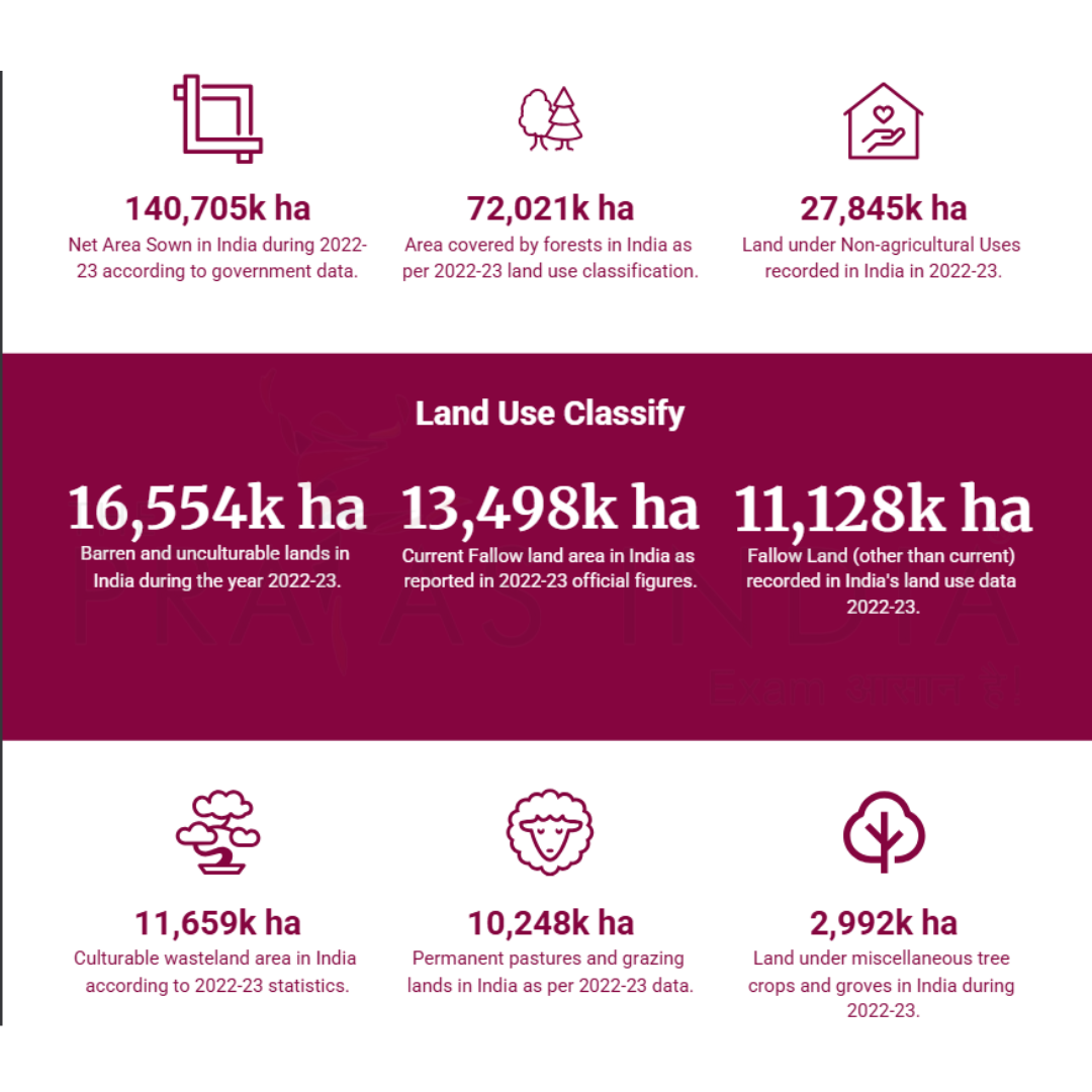
| Forests | 72,021 |
| Area under Non-agricultural Uses | 27,845 |
| Barren and Unculturable Land | 16,554 |
| Permanent Pastures and Grazing | 10,248 |
| Land under Miscellaneous Tree Crops and Groves | 2,992 |
| Culturable Wasteland | 11,659 |
| Fallow Land (Other than Current) | 11,128 |
| Current Fallow | 13,498 |
| Net Area Sown | 140,705 |
Historical Trends in Land Use
Since independence, India has witnessed significant shifts in land use driven by population growth, economic development, and technology.
- Green Revolution (1960s-70s): The adoption of high-yield varieties, fertilizers, and irrigation expanded cultivable land, particularly in the Northern Plains and Punjab, enhancing food production but also increasing chemical use and pressure on soil.
- Industrialization and Urbanization: Growing cities and industries led to conversion of agricultural and wasteland into non-agricultural uses. The net area under non-agricultural uses has risen notably since the 1950s, driven by infrastructure, housing, and industrial expansion.
- Forest Areas: Forest cover has also increased due to government afforestation programs and better demarcation, though real forest density gains vary locally.
Factors Influencing Land Use Patterns
The patterns of land use in India stem from a complex interplay of physical and human factors.
Physical Factors
- Relief and Topography: Flat terrains like Northern Plains favor extensive agriculture, while hilly or plateau regions have more forest and wasteland.
- Soil Types: Fertile alluvial soils support intense cultivation; lateritic and degraded soils are more likely under forests or uncultivable land.
- Climate: Monsoonal rainfall distribution influences cropping intensity and land suitability.
Human Factors
- Population Pressure: High population density areas show extensive land use, sometimes leading to fragmentation and degradation.
- Technological Advancements: Irrigation, fertilizers, mechanization allow agriculture in arid and semi-arid zones, altering land patterns.
- Economic Development: Shift towards industry and services increases land under urban and industrial use.
- Policies and Land Reforms: Land redistribution, ceiling acts, and forest protection laws shape access and use.
Current Land Use Statistics

According to the latest Land Use Statistics at a Glance 2022-23:
| Land Use Category | Area (Thousand Hectares) | Percentage of Reporting Area |
|---|---|---|
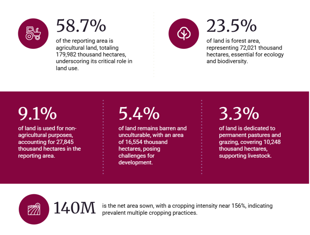
| Agricultural Land (Sum total) | 179,982 | 58.7% |
| Forest Land | 72,021 | 23.5% |
| Non-agricultural Uses | 27,845 | 9.1% |
| Barren and Unculturable Land | 16,554 | 5.4% |
| Permanent Pastures and Grazing | 10,248 | 3.3% |
| Total Reporting Area | 306,650 | 100% |
Regional Variations in Land Use
- Northern Plains: Characterised by fertile alluvial soils, a majority of land is under intensive agriculture with extensive irrigation networks. Forest cover is comparatively less.
- Peninsular India: Mixed land use with significant forest tracts (due to hilly terrain), wasteland, and moderate cropped land. Peninsular plateau soils vary from red to black, influencing crop choices.
- Northeastern India: Large forest areas dominate due to hilly topography and moderate population density. Agricultural lands are mostly shifting cultivation and terrace farming.
Issues and Challenges
- Land Degradation: Soil erosion, salinity, and nutrient depletion threaten productivity.
- Urbanization: Rapid city expansion encroaches on fertile agricultural lands leading to irreversible loss.
- Deforestation: Illegal logging and land conversion reduce forest cover impacting biodiversity.
- Land Fragmentation: Small and scattered landholdings reduce agricultural efficiency.
- Misuse of Agricultural Land: Growing industrial and infrastructural demands lead to diversion of prime farmland.
Government Policies & Reforms
- Land Ceiling Acts: Limiting landholdings to ensure equitable distribution.
- National Land Records Modernization Programme (NLRMP): Digitizing land records to improve transparency and management.
- National Land Use Policy: Framework to regulate land use changes sustainably.
- Forest Conservation Act: Restricts diversion of forest lands.
- Promotion of Agroforestry and Organic Farming: Supports sustainable agricultural land use.
Sustainable Land Management
To address challenges, India promotes:
- Watershed Management: Conserving soil and water in catchment areas.
- Soil Conservation Techniques: Contour bunding, terracing, cover crops.
- Afforestation Programs: Enhancing forest cover.
- Organic Farming: Reducing chemical inputs to maintain soil health.
- Integrated Land Use Planning: Balancing ecological, agricultural, and developmental needs.
Conclusion
Land use in India is multifaceted, shaped by natural endowments and socio-economic dynamics. While agriculture remains the backbone, pressures from urbanization and industrialization require a balanced approach. Sustainable land use planning, backed by technological advancements and policy reforms, is essential to safeguard food security, environmental integrity, and socio-economic equity for India’s future.
Important FAQs on Land Use in India
-
What is land use and why is it important in India?
Land use refers to how portions of land are utilized for agriculture, forestry, settlements, industry, etc. It is critical in India due to the country’s large population and limited land resources, impacting food security, economic development, and environmental sustainability. -
How is land use classified in India?
India follows a 9-fold classification system including agricultural land, forest land, barren land, non-agricultural uses, fallow land, wasteland, permanent pastures, miscellaneous tree crops, and uncultivable land. -
What have been the major trends in land use since independence?
Expansion of agricultural land during the Green Revolution, increase in non-agricultural uses due to urbanization, and increased forest area through afforestation programs. -
What factors influence land use patterns in India?
Physical factors such as relief, soil, and climate, along with human factors like population density, technology, economic development, and government policies. -
What are the main challenges faced in land use management in India?
Land degradation, urban sprawl, deforestation, fragmentation of agricultural land, and improper land record management. -
What government initiatives address land use issues?
Policies include land ceiling acts, National Land Records Modernization Programme (NLRMP), forest conservation laws, and programs promoting sustainable land management. -
How does sustainable land management work?
Techniques include watershed management, soil conservation, afforestation, organic farming, and integrated land use planning.


